Juta, the Chaukhi massif and the Abudelauri lakes
What is the hike from Juta to the Abudelauri lakes like?
A full-day round trip of roughly 12-14 km and 700-900 m of elevation gain to three differently coloured alpine lakes below the jagged Chaukhi massif, manageable for a fit hiker with no technical climbing involved. Crossing the higher Chaukhi Pass toward Roshka is a separate, harder undertaking usually spread over two days.
A valley with two different hikes in it
Juta is a scattering of stone farmhouses at the end of a rough side road above Stepantsminda, sitting directly below the jagged spires of the Chaukhi massif — a genuinely different silhouette from Kazbek’s smooth glaciated cone a valley over. From Juta, two distinct hikes lead into that massif, and the gap between them matters more than most guides let on. The first is a full-day walk to the three Abudelauri lakes, achievable for any reasonably fit hiker with no technical difficulty. The second is a crossing of Chaukhi Pass itself, a higher and considerably more serious route that most people treat as a two-day trek rather than a day hike. This guide covers both, and is honest about which one most visitors should actually plan for.
What Juta actually looks like
Juta is small: a cluster of stone and timber houses strung along the valley floor, a handful of guesthouses, and grazing land that climbs straight into the Chaukhi massif without much transition. There is no real village centre in the way Stepantsminda has one, no shop of any size, and mobile signal that thins out fast once you start walking.
What it has instead is proximity: the trailhead for both the Abudelauri lakes and Chaukhi Pass starts more or less at the edge of the last house, which is the whole reason people make the rough drive up here rather than day-tripping from further down the valley. Horses grazing loose on the hillside and shepherds moving stock through the settlement in early summer are a normal part of the scene, not a staged one. See Juta for a fuller picture of the settlement itself, accommodation options and what a night here actually involves beyond the two hikes covered in this guide.
The settlement empties out fast once the season turns: most of the small guesthouses that keep Juta functioning through summer are family-run and close for winter, which is one more reason mid-July to early September is treated as the practical window here rather than a loose suggestion.
Getting to Juta
Juta sits beyond Stepantsminda, reached by continuing past the Kazbegi turn-off and climbing a rougher side road that branches east off the Georgian Military Highway. The whole trip from Tbilisi takes around 3.5 to 4 hours: roughly 3 hours to Stepantsminda, then another 45 minutes to an hour on the unpaved final stretch. That last section is genuinely rough — rutted, occasionally washed out after heavy rain, and not something most rental sedans handle without scraping or getting stuck. A high-clearance 4x4 is the realistic way in for anyone self-driving; most visitors instead arrange a shared or private jeep from Stepantsminda, or book the whole day, transport included, from Tbilisi.
From Tbilisi: Juta Village and Chaukhi Mountains Hiking Tour handles the transport end to end from Tbilisi, which removes the road question entirely and is the more relaxed option if you would rather not test a rental car on the final stretch.
The Abudelauri lakes: the hike most people should do
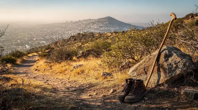
Three lakes sit in a high bowl beneath the Chaukhi massif, each a genuinely different colour — one green, one blue, one milky white from glacial sediment — close enough together to visit all three in a single push once you reach the upper valley. The trail climbs steadily out of Juta along the Chaukhivani river, through alpine meadow that turns to bare rock and scree as it nears the lakes, with the massif’s spires filling more of the sky the higher you climb. The full round trip runs roughly 12-14 km with 700-900 m of elevation gain, and most hikers take 6 to 8 hours including a proper break at the lakes themselves — this is a full day out, not a short excursion, even though nothing on the route requires technical climbing.
Abudelauri Lakes Full Day Hiking Tour covers exactly this route with a local guide, useful given how much of the trail’s appeal depends on picking the right side paths near the lakes and knowing which viewpoints are worth the extra scramble.
Weather on this hike changes fast: cloud can roll in from the ridge within an hour even on a morning that started clear, and the exposed upper section offers no shelter. Carrying a proper layer for wind and rain, regardless of how the day looks at the trailhead, is standard advice from anyone who has been caught out here.
Chaukhi Pass: a different level of commitment
Chaukhi Pass, at roughly 3,338 m, is the route that actually crosses the massif, connecting Juta to the village of Roshka on the far side in Khevsureti. It sits meaningfully higher than the Abudelauri lakes, involves longer exposure on loose, steep ground near the pass itself, and can hold snow into July in a colder year — conditions the lakes hike rarely encounters. Most people who cross it do so as a two-day trek, overnighting either in Juta before setting off or in Roshka after crossing, rather than attempting the whole thing as a single long day.
Altitude, weather that can shift with little warning, and terrain that punishes an underprepared party all argue for going with a guide who knows current conditions on the pass rather than relying on a route description alone — see Guides, gear and mountain rescue in Georgia for how to find one and what mountain rescue actually covers if something goes wrong.
Tbilisi: Private Juta Village and Chaukhi Ridge Hike is built around exactly this kind of ridge terrain with a guide who can read the day’s conditions, a sensible way to attempt the higher ground without simply following a GPS track and hoping.
Where the two routes actually diverge
Both hikes share the same first hour or so out of Juta, climbing gently along the valley floor before the ground steepens. The split comes roughly a third of the way up: the lakes route bears toward the Abudelauri bowl on a clear, well-trodden path, while the Chaukhi Pass route continues higher and further west, toward the col itself, on ground that gets progressively looser and less obviously marked the higher it climbs. This matters practically: hikers who are unsure which trail they are on should default to descending back to the fork rather than pushing on, since the pass route’s upper section is not somewhere you want to be improvising a route in poor visibility.
Reading the difference before you commit
It is worth being blunt about how different these two hikes are, because “hiking near Juta” as a phrase covers both and travellers regularly arrive expecting one and plan for the other. The Abudelauri lakes hike is long but unremarkable in difficulty: steady climbing, no exposure that would worry an average hiker, and a clear out-and-back trail that is hard to lose.
Chaukhi Pass adds real altitude, loose and occasionally exposed ground near the top, unpredictable weather at 3,300 m, and a genuine consequence if conditions turn while you are on the exposed section. Anyone unsure which category they are prepared for should default to the lakes hike and treat the pass as a separate trip requiring its own planning, ideally with a guide who has crossed it recently enough to know current snow conditions.
What to bring
For the lakes hike: sturdy boots rather than trail shoes given the loose scree near the top, a proper rain layer, more water than feels necessary since there is no reliable source once you leave the lower meadows, and food for the day, since Juta’s guesthouses do not pack trail lunches as standard. For Chaukhi Pass, add warm layers regardless of season, since temperatures at 3,300 m drop fast once cloud moves in, plus a means of navigating that does not depend solely on a phone signal, which is patchy to non-existent beyond Juta. Packing for Georgia, season by season covers the wider trip; treat this specific hike as needing more warmth and more water capacity than that general list assumes.
The Chaukhi massif itself
The jagged skyline that gives the massif its character — a row of narrow granite-grey spires rather than a single rounded summit — is what draws climbers as well as hikers to this valley, and it is worth a moment’s context. Unlike Kazbek’s smooth volcanic cone, Chaukhi’s peaks are sharper, more broken, and technical enough on the rock itself that serious climbing here is a separate pursuit from either of the walking routes in this guide, generally arranged directly with a mountaineering guide rather than booked as a standard tour. For most visitors the massif is best appreciated exactly as this guide treats it: as the backdrop to the Abudelauri lakes and the wall the pass route has to cross, not as a summit objective in its own right.
Photographing the lakes and the massif
Each of the three Abudelauri lakes photographs differently depending on the light: the green lake sits lowest and reads best in flat, overcast conditions when its colour is not washed out by glare, while the blue and white lakes higher up benefit from clearer skies and the contrast between the water and the massif’s grey spires behind them.
Midday sun tends to flatten the scene across all three, the same problem as most high-altitude water; the two or three hours either side of midday give better definition if the schedule allows for a slower pace. Cloud moving across the ridge is not purely a photography inconvenience here — it is also the first sign worth watching for a change in conditions, so treat a good photograph as a bonus rather than a reason to linger once the weather starts turning.
Season and timing
Mid-July through early September is the reliable window for both routes, with the snowline mostly retreated from the pass and Juta’s guesthouses fully open. June can still carry snow patches on Chaukhi Pass specifically, even when Juta itself and the lower lakes trail are clear and green.
By late September, nights turn cold enough that several of Juta’s small guesthouses close for the season, which matters if you are planning the two-day pass crossing rather than a single day at the lakes. See When the Georgian hiking season actually opens for how this compares to other high routes in the country, since Juta’s side valley tends to hold snow slightly longer than the main Military Highway corridor at the same elevation.
Safety, weather and when to turn back
The single biggest risk factor on both routes, but especially on Chaukhi Pass, is weather changing faster than the terrain allows you to react to it. A clear morning at Juta says very little about conditions three hours up and 1,000 m higher, and the massif’s peaks generate their own localised cloud and wind that can arrive with little warning. The standard, unglamorous advice applies here as much as anywhere in Georgia’s mountains: turn back rather than push through deteriorating visibility, tell someone at your guesthouse roughly which route you are taking and when you expect back, and treat mobile signal as unreliable rather than a backup plan.
Mountain safety in Georgia: rescue, weather and signal covers what rescue actually looks like in this part of the country if a trip does go wrong, which is worth reading before rather than after you need it. Is Georgia safe? An honest answer puts mountain-specific risk in the context of the country more broadly, for anyone weighing this trip against the rest of their plans.
Combining Juta with the rest of a Kazbegi trip
Few visitors base themselves in Juta for an entire trip; most combine it with Gergeti Trinity and a night or two in Stepantsminda, since the two hikes suit different days and energy levels.
Tbilisi: Abudelauri Lakes Guided Hike with 4X4 Transferis a practical way to fold the Abudelauri lakes into a Kazbegi-based trip without adding an overnight in Juta itself, covering the rough access road by 4x4 and leaving the walking for the upper valley where a vehicle cannot go anyway. If the whole area is a single stop on a wider Georgian itinerary, Kazbegi as a day trip: is it too much? is worth reading first, since Juta specifically does not fit comfortably into a single rushed day trip from Tbilisi the way Gergeti Trinity can.
Hikers deciding how to spend limited time in the Caucasus more broadly should also weigh Kazbegi or Svaneti?, and anyone drawn here specifically for dramatic peak scenery rather than lakes should know that Kazbek’s own glaciated summit, covered in Climbing Mount Kazbek: what it takes, is a wholly different and far more technical undertaking than anything described in this guide. Travellers with only a single day free and no interest in the rough access road may find Day hikes you can do from Tbilisi a more realistic fit than either Juta route.
Food and water along the way
Pack more water than the distance alone suggests; the route above the meadows offers no reliable source, and the exposed, sun-baked scree near the lakes and the pass makes dehydration a real risk on a long hike day. Juta’s guesthouses will generally put together a packed lunch if asked the evening before, which is worth arranging rather than assuming you can buy food along the way, since there is nothing resembling a shop once you leave the last house in the settlement. Anyone doing the two-day Chaukhi Pass crossing should also confirm with their guesthouse, in Juta or in Roshka, what dinner arrangements look like on either side, since options in both places are limited and best sorted in advance rather than on arrival.
The honest bottom line
For most travellers, the Abudelauri lakes are the hike to plan for: a long, rewarding day with three genuinely striking lakes and no technical difficulty, reachable with an early start and a full day to spare. Chaukhi Pass is a real mountain crossing that deserves to be treated as one — higher, colder, more exposed, and better attempted with a guide who knows current conditions than alone with a map. Confusing the two, or assuming a fit day-hiker can simply extend the lakes route over the pass without extra preparation, is the mistake this guide exists to head off.
Frequently asked questions about hiking near Juta
How far is Juta from Tbilisi?
Around 3.5 to 4 hours by car: roughly 3 hours to Stepantsminda along the Georgian Military Highway, then another 45 minutes to an hour up a rougher side road that climbs into the Juta valley.
Do you need a 4x4 to reach Juta?
A high-clearance vehicle is strongly advised. The road from the Military Highway to Juta is unpaved for long stretches, rutted after rain, and not something most rental sedans handle comfortably, which is why most visitors arrive by shared or private jeep rather than self-driving to the trailhead.
How long does the hike to the Abudelauri lakes take?
Most hikers take 6 to 8 hours round trip from Juta, including time at the lakes, covering roughly 12-14 km with 700-900 m of elevation gain. Fast, fit hikers do it faster; anyone stopping for a proper break at each of the three lakes should plan for the longer end of that range.
Is the hike to Abudelauri lakes difficult?
It is a long day rather than a technical one — no ropes or scrambling — but the sustained elevation gain and distance make it a genuine full-day hike rather than a casual walk, best suited to hikers already comfortable with 6+ hours on their feet.
What is Chaukhi Pass and is it harder than the lakes hike?
Chaukhi Pass, at roughly 3,338 m, connects the Juta valley to Roshka in Khevsureti on the other side of the Chaukhi massif. It is meaningfully harder than the lakes walk: higher altitude, exposed terrain, and snow that can linger into July in a cold year, which is why most people cross it as part of a two-day trek with an overnight rather than a day hike.
When is the best time to hike near Juta?
Mid-July through early September gives the most reliable conditions, with the snow on higher ground largely cleared and the weather at its most settled. June can still carry snow patches on the higher pass, and by late September nights turn cold enough that most guesthouses in Juta close for the season.
Are there guesthouses in Juta?
Yes, a small number of family-run guesthouses operate through the summer season, useful for anyone wanting an early start on the lakes hike or planning the two-day Chaukhi Pass crossing rather than a rushed day trip from Stepantsminda.
Mountain hikes on GetYourGuide
Verified deep-linked GetYourGuide tours. Book through these links and we earn a small commission at no cost to you.
Photo: our own image of the location, not the operator’s product photo.