The Georgian Military Highway, kilometre by kilometre
How long is the Georgian Military Highway from Tbilisi to Kazbegi?
About 155 km and roughly three hours by car in normal summer traffic, longer with stops at Ananuri and Gudauri, which most visitors make anyway. The road climbs from Tbilisi's 490 m to the Jvari Pass at 2,379 m before dropping into Stepantsminda, and both the pace and the weather change noticeably above Gudauri.
One road, three different landscapes
The Georgian Military Highway is not really one drive so much as three, stacked end to end. The first hour out of Tbilisi is river valley and reservoir, gentle and green. The second is a climb through forested foothills into the high Caucasus proper, culminating at a windswept pass over 2,300 metres up. The third, dropping into Stepantsminda, is bare alpine scenery with Mount Kazbek’s glacier dominating the skyline. Almost every visitor to Georgia does some version of this route, whether as a self-drive day trip, a marshrutka from Didube, or a guided tour, and knowing what each stage actually looks like — and costs — makes the difference between a rushed there-and-back and a day that earns the three hours each way.
Tbilisi: Georgian Military Highway Day Trip covers the full route from Tbilisi in a single guided day, with stops at the points below built into the itinerary rather than left to you to plan and time yourself.
Km 0-27: Tbilisi to Mtskheta
The road leaves Tbilisi northward along the Mtkvari and Aragvi valleys, reaching Mtskheta, Georgia’s ancient capital, in about 25 minutes. Most Military Highway day trips either skip Mtskheta entirely, having covered it on a separate day, or make a brief stop at Jvari Monastery’s hilltop viewpoint over the river confluence before continuing north. If Mtskheta is not already on your itinerary elsewhere, this is the natural point to fold it in without a significant detour.
Km 27-65: the Aragvi valley to Ananuri
Past Mtskheta the road follows the Aragvi River north through Kartli’s foothills, climbing gently through villages and orchards before reaching the Zhinvali reservoir, a striking turquoise lake formed by a Soviet-era dam. Ananuri Fortress, a walled complex of towers and churches on the reservoir’s southern shore, sits right on the highway and is the single most photographed stop on the entire route — reachable in about 45 minutes from Tbilisi and worth 20-30 minutes on foot. Entry is free. See Ananuri Fortress and the Zhinvali reservoir for the fuller picture of what is inside the walls.
Km 65-120: Pasanauri to Gudauri
Beyond Ananuri the road climbs more seriously, passing through Pasanauri — known locally for khinkali, worth a stop if lunch timing allows — before switchbacking up toward Gudauri, Georgia’s main ski resort, at around two hours from Tbilisi. In winter this stretch is where snow first becomes a serious factor; in summer it is simply where the temperature drops noticeably and the views open out across the Aragvi valley below.
Gudauri itself, at 2,196 m, is the natural lunch stop for anyone driving straight through, and also the launch point for paragliding flights that run through the warmer months — see Paragliding at Gudauri and, for winter visitors, Skiing Gudauri: lifts, snow and lift passes.
Location Georgian Military Highway Tour with Paragliding combines the drive itself with a paragliding flight over Gudauri, for visitors travelling in the May-October window when conditions allow it.
Km 120-135: the Jvari Pass
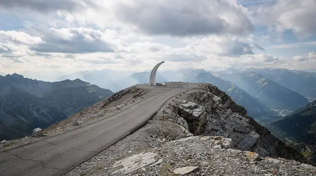
The road’s highest point, the Jvari Pass (also called the Cross Pass, unrelated to the Jvari Monastery near Mtskheta despite the shared name) sits at 2,379 metres, marked by the Russia-Georgia Friendship Monument, a Soviet-era mosaic-covered viewing platform built in 1983 that has become one of the highway’s more photographed stops almost by accident. The pass is where the character of the drive changes most abruptly: trees give way to bare alpine slopes, and in winter this is the section most likely to close temporarily during heavy snow, sometimes for several hours while road crews clear drifts. Wind at the monument itself is often sharp enough that a five-minute stop is about right for most visitors rather than a lingering one.
Km 135-155: Kobi to Stepantsminda
Past the pass the road drops through Kobi, where a side road branches toward the Truso Valley’s travertine springs — see Truso Valley and its travertine springs for that detour — before descending into Stepantsminda, universally known to visitors as Kazbegi, at around three hours from Tbilisi.
This is the practical end of the road for almost everyone: the town sits at 1,740 m with Mount Kazbek, at 5,054 m, and the hilltop Gergeti Trinity Church dominating the view above it. Reaching the church itself is a separate short drive or hike up a rough track from town — see Hiking to Gergeti Trinity from Stepantsminda for how that final leg works.
Explore Ananuri Gudauri Kazbegi Guided Day Tour ties Ananuri, Gudauri and Kazbegi together as a single guided itinerary, which suits anyone who would rather not plan the stops and timings themselves.
Beyond Kazbegi: the Dariali Gorge and the Russian border
The paved road continues roughly 10 km past Stepantsminda through the narrow Dariali Gorge to Verkhny Lars, the working Georgia-Russia border crossing. This is not a tourist stretch for most visitors: the crossing exists mainly for freight and for the small number of travellers with the visas needed to cross into Russia, and heavy truck traffic queuing for the border adds slow-moving congestion to the final approach that is worth knowing about even if you have no intention of going that far. For everyone else, Kazbegi itself is the end of the road.
Cost of doing the drive
A shared marshrutka from Didube station to Stepantsminda runs 15-20 GEL each way and takes roughly the same three hours as driving yourself, departing when full rather than on a fixed timetable. A private driver for the full day, with stops at Ananuri and Gudauri built in, typically costs 250-400 GEL for the car regardless of how many people are travelling, which is often cheaper per person than a rental once fuel and the mental effort of the switchbacks are counted.
Self-driving costs whatever your rental and fuel come to — see Renting a car in Georgia for the specifics — plus the concentration the mountain sections genuinely demand; see Driving in Georgia: rules, roads and habits for what to expect from other traffic on this exact road.
From Tbilisi: Day Trip to Gudauri and Kazbegi is a lower-cost small-group alternative to a fully private tour, for anyone happy to share the vehicle with a handful of other travellers.
Winter on the highway
Between roughly November and April, expect the whole character of the drive to change. Snow tyres become close to mandatory rather than optional, chains are worth carrying on a 4x4, and the Jvari Pass section can close for several hours at a time during and immediately after heavy snowfall while crews clear it — check road conditions the morning of travel rather than assuming the route is guaranteed open, particularly after a forecast of heavy snow overnight.
Gudauri, unsurprisingly, gets busier rather than quieter in winter, as the ski season brings its own traffic to the same road. See When the mountain passes open and close for how this compares with Georgia’s other seasonal routes, several of which close entirely rather than merely slowing down.
Is it worth doing as a day trip, or better with a night in Kazbegi?
Three hours each way makes a same-day round trip from Tbilisi a full twelve-hour undertaking once Ananuri, Gudauri and Gergeti Trinity are folded in, which is doable but leaves Kazbegi itself feeling rushed. An overnight in Stepantsminda — guesthouses run 40-70 GEL a night — turns the same route into a more relaxed two-day trip with time for a proper hike toward Gergeti glacier or the Truso Valley on the second morning. See Kazbegi as a day trip: is it too much? for the fuller argument either way, and Kazbegi or Svaneti? if you are weighing this route against Georgia’s other headline mountain trip.
Why it is called “military”
The name predates tourism entirely: the route follows a path used since antiquity through the Caucasus, but was formalised and improved by the Russian Imperial army in the late eighteenth and early nineteenth centuries as the main supply corridor between Russia and its territories south of the mountains, following the Aragvi and then the Baidara valley up to the pass before dropping to the Terek on the northern side.
Alexander Pushkin and Mikhail Lermontov both wrote about travelling it, and the road’s military function persisted through the Soviet period, which is part of why the 1983 Russia-Georgia Friendship Monument at the Jvari Pass has the particular Soviet-era, slightly propagandistic character it does. The name has stuck by habit rather than current function — the road today carries considerably more tourist traffic and freight than anything military.
What the drive actually feels like
Numbers on a map understate how much the landscape changes across three hours of driving, and first-time visitors are usually surprised by how quickly the scenery shifts once the road starts climbing in earnest past Pasanauri. Leaving Tbilisi, the Aragvi valley is green, cultivated and gently rolling, closer in feel to Kartli’s vineyard country than to mountains. By Pasanauri the valley has narrowed and steepened, forest presses close to the road, and the switchbacks begin in earnest.
Above Gudauri, tree line gives way abruptly to open alpine slope, the air noticeably colder and thinner even from inside a car, and cloud frequently sits below the pass itself on a day that was clear in Tbilisi — worth knowing before setting out, since a warm, sunny departure gives no guarantee about conditions two hours later. Dropping into Stepantsminda, the valley opens out again into the wide bowl beneath Kazbek, dramatic enough that most first-time visitors pull over for photographs before reaching the town itself.
Altitude and how it affects most visitors
The Jvari Pass, at 2,379 m, sits below the altitude where sickness becomes a serious medical concern for most people, and the short duration spent at that elevation — a five- or ten-minute stop rather than sustained exertion — means it rarely causes more than mild breathlessness or a slight lightheadedness for visitors unused to altitude. Stepantsminda itself, at 1,740 m, causes no issues for the vast majority of travellers. The exception is anyone planning to continue up toward Gergeti glacier or attempt Mount Kazbek itself, where altitude becomes a genuine factor requiring the acclimatisation schedule covered in that guide rather than anything relevant to the drive alone.
Villages along the way worth a glance
Beyond the headline stops, the highway passes several small villages worth a slower look if you have the time. Pasanauri, already mentioned for khinkali, sits at the confluence of the Black and White Aragvi rivers and makes a natural halfway break on the Tbilisi side of the pass.
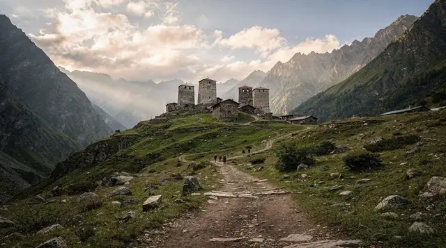
Sno, a short detour off the main road not far before Kazbegi, is a stone-tower Khevsur village that gives a glimpse of the fortified mountain architecture more commonly associated with Khevsureti further east, without the long drive that region itself requires. Arsha, close to Gudauri, has a small mineral spring locals still stop for on the way past. None of these need a dedicated stop on a first visit, but they are worth knowing about if the main highlights leave you with spare time.
Fuel, food and toilet stops along the route
Petrol stations are reliable as far as Gudauri and present, if less frequent, on to Stepantsminda, so fuel is not a genuine concern on this route even in winter. Food options cluster at three points: Ananuri has small cafés by the car park, Pasanauri is the recognised khinkali stop with several family-run places along the main road, and Gudauri has a wider range from ski-season restaurants to simple roadside khinkali houses that stay open through summer as well. Toilet stops are easiest at the same three points; the stretch immediately around the Jvari Pass itself has none beyond a basic facility at the monument car park.
Traffic patterns and when to go
Weekday mornings, particularly outside July and August, are the quietest time to drive this route, with traffic building noticeably on summer weekends as Tbilisi residents head for Gudauri’s cooler air alongside the tourist traffic bound for Kazbegi. Freight trucks queuing for the Russian border add slow-moving congestion on the steeper switchback sections at almost any time, which is where the overtaking hazards described in Driving in Georgia: rules, roads and habits concentrate most heavily — patience through these sections, rather than an attempt to overtake a slow truck on a blind bend, is the single most useful piece of advice for this specific road.
Packing for the day
Temperatures at the Jvari Pass and around Kazbegi run noticeably cooler than Tbilisi at almost any time of year, often 8-12°C lower, and wind at the pass itself adds a further chill factor that catches out visitors who left Tbilisi in summer clothing. A layer warmer than what feels necessary in the city, plus a windproof shell, covers most of the year; from November to April, treat it as a genuine winter outing regardless of what the weather is doing in Tbilisi that morning.
Sunglasses and sun cream matter more than the temperature suggests, since altitude and reflected light off snow or bare rock burn faster than expected even on a cool day. For anyone planning to walk up toward Gergeti Trinity Church rather than drive the 4x4 track, sturdier shoes than city trainers make the last steep stretch considerably more comfortable.
How this route compares to reaching Kazbegi any other way
There is, in practice, no realistic alternative: the Georgian Military Highway is the only paved road connecting Tbilisi to Stepantsminda, so every marshrutka, private driver, tour bus and self-driven rental covers the same physical route regardless of how it is booked. The choice that actually matters is not which road to take but which way to travel it — self-drive, shared marshrutka, or private or small-group tour — each covered above with its own cost and stress trade-offs.
What changes the experience more than the mode of transport is timing: an early weekday departure clears the pass in good light with minimal traffic, while a Saturday afternoon in August shares the same switchbacks with a considerably larger share of Tbilisi’s population headed the same way.
Frequently asked questions about the Georgian Military Highway
See the FAQ block above for specifics on cost, winter closures, the highest point of the route and where the road actually ends — the short version is a three-hour paved drive from Tbilisi to Kazbegi, doable year-round with the right tyres in winter, and worth the stops at Ananuri and Gudauri that most day trips already build in along the way. Whichever way you cover it, the road rewards a slower pace over a rushed one: the three hours from Tbilisi to Kazbegi are, for most visitors, one of the single best value stretches of driving anywhere in the country, and the stops along the way are as much the point of the trip as the destination waiting at the far end of it.
Is the Georgian Military Highway open all year?
Yes, it is the main paved route to Kazbegi and stays open through winter, but the Jvari Pass section closes temporarily during heavy snowfall, sometimes for several hours while crews clear it. Check conditions before setting out between November and April, and expect winter tyres to be necessary rather than optional.
How much does a Kazbegi day trip along the Military Highway cost?
A shared marshrutka from Didube station to Stepantsminda runs about 15-20 GEL each way. A private driver for a full day, covering Ananuri and Gudauri as stops along the way, typically costs 250-400 GEL for the car, split between however many people are travelling.
What is the highest point on the Georgian Military Highway?
The Jvari Pass, also called the Cross Pass, at 2,379 metres, marked by a Russian-built monument and viewpoint that most drivers and marshrutkas stop at briefly. It is the clearest single point where the road tips from Kartli’s foothills into the high Caucasus proper.
Can you drive the Georgian Military Highway in a normal rental car?
Yes in summer, since the road is fully paved from Tbilisi to Stepantsminda. In winter, snow tyres are close to mandatory and a 4x4 is the safer choice given the Jvari Pass’s exposure to drifting snow and ice, even though the road itself stays paved.
Where does the Georgian Military Highway actually end?
At Stepantsminda (Kazbegi), the practical endpoint for almost every visitor, though the paved road continues a further 10 km through the Dariali Gorge to the Russian border crossing at Verkhny Lars, a working but visa-restricted crossing that is not a tourist route for most nationalities.
What should I stop for along the way?
Ananuri Fortress and the Zhinvali reservoir it overlooks, about 45 minutes from Tbilisi, are worth the stop for almost everyone. Gudauri, roughly two hours in, is the natural break for lunch and mountain views before the final climb. The Russia-Georgia Friendship Monument just past the Jvari Pass is a five-minute stop most people make for the mosaic and the view alone.
Is the Georgian Military Highway busy with traffic?
In July and August, yes, particularly on weekends when it doubles as the route to Gudauri’s cooler summer air and Kazbegi’s hiking. Trucks heading toward the Russian border add slow-moving traffic on the steeper switchback sections, which is where the road’s overtaking hazards concentrate.
Transfers and transport on GetYourGuide
Verified deep-linked GetYourGuide tours. Book through these links and we earn a small commission at no cost to you.
Photo: our own image of the location, not the operator’s product photo.